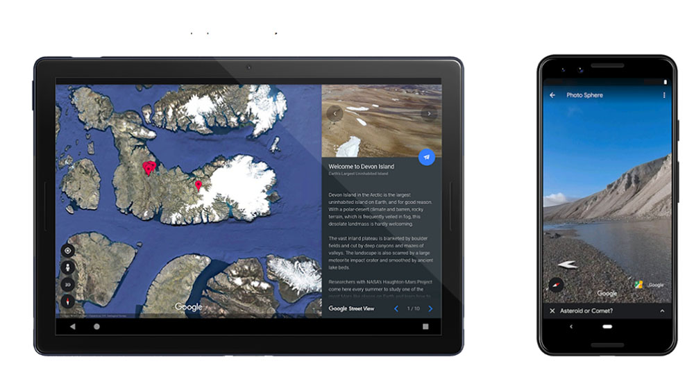
‘Mars on Earth’

If you’re curious about what it’s like to live on the Red Planet, Google will now let you explore Devon Island, also known as “Mars on Earth,” right on your computer screen.
Google Street View recently added images of Devon Island, a giant uninhabited island on Earth, to its picture collection,” Fox News reported. This island, which has been deemed “unlivable” and is located in the Canadian Arctic, was nicknamed “Mars on Earth,” because its weather and terrain are the closest environments to Mars on our planet.
Google created a cool website dedicated to Devon Island, and noted how the, “polar-desert climate and barren, rocky terrain,” work well for researchers who visit the area each summer and would like to prepare for future Red Planet explorations.
The tech company collaborated with Haughton Mars Project (HMP) researchers to teach people about Devon Island. According to the project’s website, it studies different types of strategies, technologies, and training methods for future Mars missions. HMP also focuses on deep space, the moon, and near-Earth objects, which HMP says are, “key stepping-stones in the exploration of Mars.”

One of the most important areas HMP is studying is the 23-million-year-old Haughton crater, which HMP says, “resembles the Mars surface in more ways than any other place on Earth.” The Haughton crater, which was once occupied by a massive lake, has a 12.4-mile-wide impact structure and was caused by an asteroid. Due to Devon Island’s mostly cold and dry climate, the crater hasn’t suffered from much erosion damage. According to Google Earth’s Devon Island website, the crater is known as one of the best-preserved impact structures on our planet.
You can explore “Mars on Earth” and learn about Devon Island research with this Google Earth guided tour.

